Showing posts with label Lower Springs Mining District. Show all posts

Wednesday, May 27, 2026

The Disappearance of Ruth (Bedford) Rhoades-Knight: A MURDER AT THE OLD SPANISH MINE.


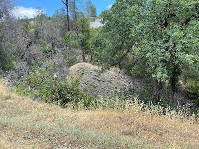
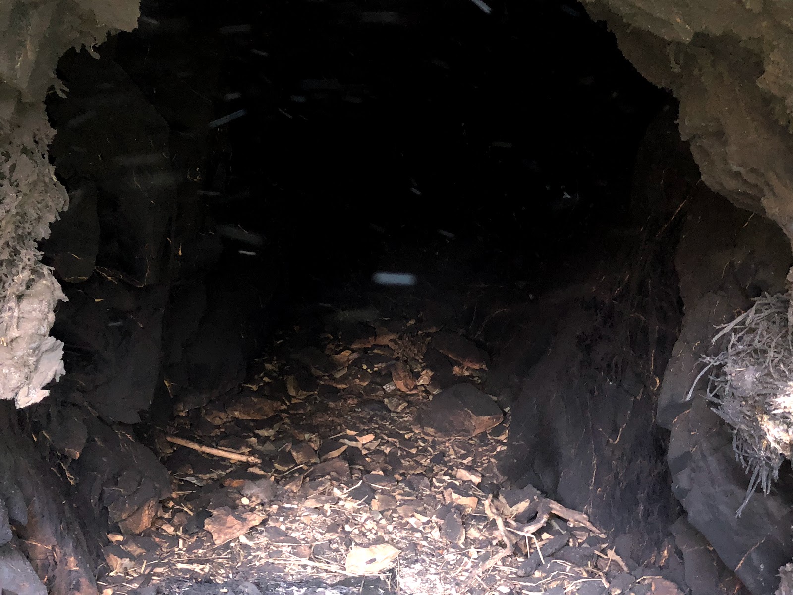
The historic Old Spanish mine was located and prospected by local miners before, the year 1894, and was once a lucrative producer of gold in the boundaries of the Lower Springs Mining District, near Redding, California, which was later subdivided into a local neighborhood with modern homes. Its adits and winzes were also plugged for safety reasons at that time as well. However, its history can still be documented, and this former mining property is where Shasta County authorities removed the remains of Mrs. Ruth (Bedford) Rhoades-Knight who went missing from Marysville, California, in 1945, eighty-one years ago. Mrs. Knight's gruesome murder occurred at the Old Spanish mine, and her body was dumped into a 60-foot winze of this mine by her husband, Louis Barney Knight. For those of you who are true crime fans I hope you enjoy this episode of Exploring Shasta County history as I trace the life and chilling murder of Mrs. Ruth (Bedford) Rhoades-Knight whose tragic story has become forgotten over the years. She is buried in the Anderson District Cemetery in Anderson, California. For more information click the YouTube link below, please watch, like, comment, share and subscribe to my YouTube channel.


RESOURCES:

1900 U.S. Census

1910 U.S. Census

1920 U.S. Census

1930 U.S. Census

1940 U.S. Census

Woman's Body Found in Mine is Identified - The Sacramento Union newspaper of Sacramento, July 21, 1946

Hubby Held In Mine Death - The Record Searchlight newspaper of Redding, July 22, 1946

California Authorities Enroute to Return 1st Degree Murder Suspect - The Daily Herald newspaper of Provo, Utah, July 23, 1946

Man Will Face Slaying Probe - The Albuquerque Tribune newspaper of Albuquerque, New Mexico, July 23, 1946

The Deseret News newspaper of Salt Lake City, Utah, July 23, 1946

Knight Waves Extradition in Shasta Slaying - The Sacramento Bee newspaper of Sacramento, July 24, 1946

Slain Woman's Husband Held on Murder Charge - The Chico Record newspaper of Chico, July 24, 1946

Knight Agrees to Face Wife’s Death Inquiry - The Albuquerque Journal newspaper of Albuquerque, New Mexico, July 25, 1946

Man Held in Utah for Shasta Death - The Salinas Californian newspaper of Salinas - July 25, 1946

Knight Waves Extradition in Mine Slaying - The Sacramento Union newspaper of Sacramento, July 25, 1946 

Knight Declares That Wife Killed Self - The Shasta Courier newspaper of Shasta, July 25, 1946

The Almost Perfect Crime - The Record Searchlight newspaper of Redding, July 25, 1946

Suspect Admits Striking Wife With Hatchet Officers Say -  The Salt Lake Tribune newspaper of Salt Lake City, Utah, July 25, 1946

Mine Murder Count Names Louis Knight - The Record Searchlight newspaper of Redding, July 25, 1946

Knight is Taken to Murder Scene at Shasta Mine - The Sacramento Bee newspaper of Sacramento, July 26, 1946

Knight Craves Water; Has Sheriff Shake Rain Water Onto His Face - The Record Searchlight newspaper of Redding, July 26, 1946

Knight Declares Wife Suicide - The Redding Record Searchlight newspaper of Redding, July 26, 1946

Knight to Stand Murder Trial - The Sacramento Bee newspaper of Sacramento, July 26, 1946

Officer Studies Knight Murder Car - The Daily Herald newspaper of Provo, Utah, July 26, 1946

Knight's Story Unchanged at Murder Scene - The Sacramento Union newspaper of Sacramento, July 27, 1946

Coroner's Jury Indicts Knight - The Sacramento Union newspaper of Sacramento, July 29, 1946

Knight is Held Responsible for Death of Wife - The Sacramento Bee newspaper of Sacramento, July 29, 1946 

Jury Names Knight As Slayer - the Record Searchlight newspaper of Redding, July 29, 1946

Knight May Get Hearing Tomorrow - The Record Searchlight newspaper of Redding, July 30, 1946

Knight Sticks to Same Story - The Record Searchlight newspaper of Redding, July 31, 1946

Knight Confesses Slaying - The Record Searchlight newspaper of Redding, August 1, 1946

Knight Arraignment Continued; Toung-Slip Helped Break Case - The Redding Record Searchlight newspaper of Redding, August 2, 1946

Delay is Granted Confessed Wife Slaying for Plea - The Sacramento Bee newspaper of Sacramento, August 2, 1946

Knight Admits Wife Murder - The Sacramento Union newspaper of Sacramento, August 2, 1946

Knight Given Delay Before Making Plea - The Sacramento Daily Union newspaper of Sacramento, August 3, 1946

Slip of Tongue Brings Confession in Knight Case - The Chico Record newspaper of Chico, August 4, 1946

Knight Arraignment Continued; Tongue Slip Helped Case - The Shasta Courier newspaper of Shasta, August 8, 1946

Knight Given Postponement- The Record Searchlight newspaper of Redding, August 13, 1946

The Daily Herald newspaper of Provo, Utah, August 14, 1946

Body of Former El Dorado Woman Discovered in Mine - The El Dorado Springs Sun newspaper of El Dorado Springs, Missouri, August 15, 1946

Knight Guilty; Goes to Prison - The Record Searchlight newspaper of Redding, September 3, 1946

Knight Pleads Guilty to Wife Slaying Charge - The Sacramento Bee newspaper of Sacramento, September 4, 1946

Louis Knight Gets Five Year to Life for Murder of Wife - The Daily Herald newspaper of Provo, Utah, September 5, 1946

Knight Sentenced in Wife Slaying - The Albuquerque Journal newspaper of New Mexico, September 5, 1946

Engineer Captured at Provo, Draws Sentence in Killing - The Salt Lake Tribune newspaper of Salt Lake City, Utah, September 5, 1946

Wife Slayer Seeks Parole - The Shasta Courier newspaper of Shasta, February 12, 1948

North State Felons - The Sacramento Bee newspaper of Sacramento, March 30, 1948

California, U.S., Prison and Correctional Records, 1851-1950 for Louis Knight

1950 U.S. Census

The Sacramento Bee newspaper of Sacramento, January 24, 1950

Three Convicts Appeal Terms - The Shasta Courier newspaper of Shasta, January 26, 1950

Parole Denied - The Sacramento Bee newspaper of Sacramento, March 27, 1950

Authority Acts on Parole Requests - The Redding Record Searchlight newspaper of Redding, March 18, 1953

The Sacramento Bee newspaper of Sacramento, April 8, 1954

Murder of 1945 to be Reviewed - The Redding Record Searchlight newspaper of Redding, January 8, 1955

The Sacramento Bee newspaper of Sacramento, March 24, 1955

Man 79, Gets Prison for Molesting Girl, 8 - The Sacramento Union newspaper of Sacramento, October 11, 1967

Bob L. Knight Obituary - The Sacramento Union newspaper of Sacramento, May 20, 1969

Thursday, June 8, 2023

Salt Creek Group of Mines


The Salt Creek Group of Mines was worked by E.P. Connor as early as 1897, and this lucrative mining property was abandoned in 1916. The largest producer of gold of this mining property is the Corrine mine. Filmed on location June 6, 2023. Find out more about the Salt Creek Group of Mines in this video from Exploring Shasta County History...
  

Wednesday, June 30, 2021

A REDEVELOPED AND SUBDIVIDED PATENTED MINING PROPERTY: THE TILTON CONSOLIDATED MINE


The main tailing pile of the Tilton mine towering above the hillside off Valparaiso Way. This photograph was taken by Jeremy Tuggle on May 22, 2021.


On January 1, 1902, a prospector and miner named Richard P. Wheelock struck an appealing quartz vein which warranted further investigation of the land he was prospecting on. After that, he sunk a shaft and drove an adit into a hillside establishing a lode mine, which led him to a bonanza of gold. He then called this mining claim the Tilton mine, which was situated west of Redding, and in the boundaries of the Lower Springs mining district. A year later, on January 2, 1903, Wheelock located another lucrative vein of quartz which he called the Dictator mine, after that he sunk a winze on this property which embraced the Tilton mine property. Wheelock then began referring to these mining claims as the Tilton Consolidated mine.

On February 4, 1903, Wheelock located the lucrative quartz vein of the New Redding Gold mine which was merged into the Tilton Consolidated mine holdings, followed by the discovery of the Kamaaina Gold mine quartz vein on September 15, 1904, after that it was merged into the Tilton Consolidated mine holdings which were all owned and operated by Richard P. Wheelock. Four years later, the Tilton Consolidated mine became a patented mining claim on February 3, 1908 under Wheelock's ownership.


Above: map of the Tilton Consolidated mine surveyed by Alfred Baltzell, dated March 1907.


Eventually, Doctor Sherman T. White, of Redding, bought the property, and the following article was heralded by the Blue Lake Advocate newspaper which printed the following on October 24, 1925:

Mine In Shasta To Be Sold

Redding (Shasta Co.) Oct. 20., Dr. Sherman T. White has agreed to sell to F.L. Kendall the Tilton group of mines between Middle Creek and Centerville for $4,000. The group includes the Tilton, Dictator, New Redding, and Kamaana gold mines. The agreement to sell extends for a period of three years, but work must be kept up continuously.” (SIC)

About the year 2000, this mining property was redeveloped and subdivided. This former mining property is located off Lower Springs Road with residential homes in the neighborhood of Valparaiso Way and Tilton Mine Road, which retains the name of the original mine. Today, only two tailing piles belonging to the Tilton Consolidated mine are visible off of Valparaiso Way. The winzes and adits are plugged, and there weren’t any production notes recorded for this former mining property. 


Above: a second smaller tailings pile exist just off Valparaiso Way in a gulch below a private residence. This photograph was taken by Jeremy Tuggle on May 22, 2021.


Above: a Shasta County Assessors Map - Book 204, Page 19, County of Shasta, dated: 2000.


RESOURCES:

Mineral Survey No. 4597, Plat of the Claim of R.P. Wheelock, known as the Tilton Consolidated Mine, embracing the Tilton, Dictator, New Redding Gold and Kamaaina Gold Mines. Surveyed by Alfred Baltzell, March 1907. Patented: February 3,1908.

Mine In Shasta To Be Sold - The Blue Lake Advocate newspaper of Blue Lake, October 24, 1925

Middle Creek & Lower Springs Mining District 622 Mining, available at the Shasta Historical Society

Shasta County Assessors Map - Book 204, Page 19, County of Shasta, 2000


Wednesday, December 26, 2018

LOWER SPRINGS


Above: a cabin at Lower Springs. This photograph was taken in 1900. Courtesy of Shasta Historical Society.

After the first two gold discoveries in California were confirmed to be true, scores of people descended into California from around the world, and onto the Rancho Buena Ventura in 1849. As Gold Rush pandemonium struck this region and populated places near it, the forty-niners began pitching up their tents at a rapid pace. These people made their camp sites about two miles southeast of Reading Springs. After that, they began to prospect the nearby creek channels to stake out their placer mining claims. Not everyone was successful at mining. 

At this location, a tent community called Lower Springs was established by these forty-niners, that year. Lower Springs became one of the original gold rush communities of Shasta County. This new tent community was named Lower Springs because its name derived from the nearby community of Reading Springs. Later on, the name of Reading Springs was changed to Shasta on June 8, 1850, and the community of Lower Springs kept its name.

A man by the name of Benjamin Swasey was among the first settlers of this flourishing mining community. He was a native of New Hampshire and he arrived in Shasta County in 1849. After his arrival, the Lower Springs mining district formed its boundaries in the area. Some people made their fortune while others weren't as lucky, yet these miners kept locating new placer mines in this mining district. During the summer months, the Lower Springs mining district became dry diggings with the lack of rain, and water resources were unavailable for miners to use in their placer mines at that time.

Eventually, the rain fell and restored the water in the creek channels every year, as early as fall or as late as winter, however; summer rain storms were known to happen.  It was Swasey who purportedly owned some land near Lower Springs at Gold Gulch. Gold Gulch was a tributary of Salt Creek which reportedly yielded him, $1,500 to the cubic yard in gold. Salt Creek was another stream which channeled near Lower Springs.

In 1850, the first wooden home structure was erected at Lower Springs, and soon after, other homes were completed with additional bungalows and cabins. Lower Springs had a thriving population during its hey-day, the exact number of settlers weren't recorded. However, Lower Springs' population fueled this flourishing community to be a contender for the county seat of Shasta County, along with Horsetown and Shasta, in the running on the ballot at the local primary election in 1851. This is when the county seat was removed from the Reading Adobe at Cottonwood to Shasta.

Then on, March 6, 1851 the town of Shasta became the second county seat of Shasta County. The original location of Lower Springs was on the stage road which routed rigs from Canon House (Canyon House) to Shasta. The current site is located a quarter-mile west of the junction of Highway 299 and Ridge Drive.

The burgeoning community of Lower Springs was prone to Indian attack's, and the Indians raided many cabins in the area at that time, taking with them all of the supplies and provisions the early settlers owned. Then on, April 17, 1851, a man by the name of Merady Swan, a native of Missouri, was murdered by Indians in this community. The following article is from the Sacramento Transcript newspaper of Sacramento:

"Killed By Indians - A man named Merady Swan formerly of Missouri, was shot in his cabin at Lower Springs, two miles this side of Shasta City, one night last week. The Indians slipped up to his cabin at night and shot him through a crack in the door, while he was sitting at the table. Several other persons were in the house, which prevented them from robbing it." (SIC)

In May of 1852, the miners of this mining district were averaging five dollars to the pan per day on Salt Creek. A new settler to the area by the name of Jonathon F. Gage, a native of New Hampshire, erected a log style house there. Gage was married to Alice Jane Swasey a sister of Benjamin Swasey. Jonathon’s profession was farming but he also tried his hand at mining. Together they raised a large family, and then in 1866 they relocated from Lower Springs to Middletown, this is where Gage registered to vote that year.

In 1853, Benjamin Swasey filed a land claim at Shasta, for one hundred and sixty acres of land at Lower Springs, and then he erected a house on this property for him to live in. He also erected two additional buildings at Lower Springs for his businesses. Swasey became the proprietor of the Swasey hotel and the Swasey mercantile store. The hotel included a large barn and a corral with a natural spring of water. Hay and barley were also stocked in the hotel's barn. His business prospered as Swasey advertised in the Shasta Courier newspaper from Shasta. 


Above: an advertisement for Swasey's hotel at Lower Springs, the ad above is from the Saturday, January 21, 1854 edition of the Shasta Courier newspaper.


Above: this is an upper torso photograph of an elderly, Benjamin Swasey. Benjamin was born on January 31, 1822 in New Hampshire and he died in Oakland, Alameda County, California on September 19, 1912, at the age of ninety. He is buried at Redding in the Redding Memorial Park. He was married twice, first to Nellie Dalton, and second to, Emily Marshall. Then in 1861, Swasey became a photographer and relocated to San Francisco. This image was taken circa 1880s at Vance's Gallery in San Francisco. Courtesy of Shasta Historical Society.


Aside from the businesses owned by Benjamin Swasey, this community also included a boarding house called the Virginia House and a blacksmith shop which was owned and operated by Henry Jones. Jones was a native of Ohio, and he was married to his wife, Emily. There was at least one son produced during this union which they named James Jones. At a later date, Henry Jones changed his profession to become a gunsmith.

Then on, Saturday, April 2, 1853, the Shasta Courier newspaper reported the following information in the forthcoming article:

"DIGGINGS ABOUT LOWER SPRINGS - We have heard of remarkably good wages being made within the past few days in these diggings, and what is more, we know it to be true. Dr. Dunlap, in digging a cellar under his house, took the trouble to prospect the dirt, and found it paid upwards of two cents to the pan from the surface to the bed rock. This ground of course would pay fine wages for sluicing, if water was to be had." (SIC)

Later that month, additional excitement occurred at the placer mines on the hillside above the Virginia House, which yielded lucrative results to local miners. Miners also crossed the main stage road to the land opposite of the boarding house and they made the most gratifying success there. There were many delightful parties were held at the Swasey house where people danced the night away and during each ball a supper was prepared by Swasey’s wife, Nellie, to serve the guests. Anyone was welcome to join them and it was a great way for the lonely miners of the area to interact with the beautiful and single ladies.

The following year, the miners of the area were extremely harsh on the Chinese immigrants in the Lower Springs mining district, and at that time, they voted to ban all Chinese immigrants, and then, they forced them to turnover their mining properties to the miners of the area which were not of that race, and the "white miner" weren't the only race to enforce this policy. Hong Kong, near Shasta was closest Chinatown to Lower Springs, which was located two miles away. There were quite a number of anti-Chinese mining districts in Shasta County. Lower Springs wasn't the only mining district to evict the Chinese.


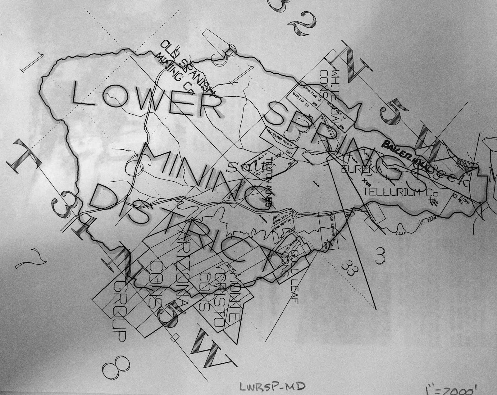
Above: This undated surveyed map shows the boundaries of the Lower Springs mining district and some of the mines included. Please note the name: the Old Spanish Mining Co., of course other mines and companies are noted on it as well. 

In the fall of 1854, a brand new trading post was established at Lower Springs by J.D. Dunlap & Company, and they began advertising their general merchandise store in the local media. Two months later, in December of that year, the first rain eventually fell, and miners had an abundance of water to use. The miners started washing their placer mines and they were making one hundred dollars per day by rocker at that time.


Above: an advertisement for J.D. Dunlap & Company at Lower Springs. This ad is from the Saturday, October 21, 1854 edition of the Shasta Courier newspaper.


The construction of the Clear Creek Ditch, sometimes referred to as the Clear Creek Canal, began in December of 1853. Local miners raised the money to back this large project to convey the water of Clear Creek into the nearby dry diggings of Briggsville, Horsetown, Lower Springs, Muletown, Shasta and Whiskeytown. The ditch connected with a large reservoir which was built as a major part of this project.

Local miners celebrated the ditches completion on November 24, 1855. The length of this ditch measured at sixty miles. The reservoir at Middletown covered fifteen acres to a depth of eight feet. Immediately, the water from this ditch began conveying water into the Lower Springs mining district at Salt Creek. The miners at Lower Springs now had an abundance of water to use in their mining claims.

There wasn't much of a ruckus at Lower Springs between the years 1856 and 1857; however, this community managed to stay relevant. The miners in the area focused on their placer mines, and local businesses advertised their companies in the local media. However, in July of 1857, Swasey’s hotel was still owned by Benjamin Swasey, but it was now under new management. A man by the name of Willam H. Bond was hired by Swasey to manage the hotel for him. Swasey still ran his mercantile store but his extra time was focused on being the public administrator of Shasta County, which is part of the reason he couldn’t manage both the mercantile store and the hotel by himself.


Above: an advertisement for the Administrator's Sale of Real Estate for the estate of T.B. Pritchett, deceased. This estate sale was held on Main Street at Texas Springs, in Shasta County, by Benjamin Swasey, Public Administrator on August 22, 1857. The above ad is from the Saturday, August 8, 1857 edition of the Shasta Courier newspaper.

Two years later, on February 19, 1859, the Shasta Courier newspaper heralded the following article:

Pottery - The manufacture of pottery has been fairly commenced by Messrs., Bly & Co., at Lower Springs. It is the first manufactory of the kind that we have heard of being established in the Northern part of the State. The first kiln was burned a few days ago. It was entirely successful and the ware is of excellent quality. We have been presented with a large pitcher from this first kiln and we value it highly. It argued well for California to witness the commencement of manufacturing establishments throughout the State - however, humble they may be in their inception. We wish Messrs., Bly and Co., an abundant reward in the pursuit of their laudible enterprise.” (SIC) 

Apparently, the above article by the Shasta Courier newspaper conflicts with previous statements by local historians who claimed that, a man by the surname of Tozure, had owned and operated the first pottery shop at Lower Springs. There's no information to suggest that Tozure was employed by Bly and Company, or that Tozure had become Bly and Company’s successor at Lower Springs. There might have been two different pottery shops at different era's in this community, in operation, because the above article suggest otherwise.

This quiet burg was interrupted one day, in January of 1863, by an affray started by Lawrence O' Connell who assaulted William Thompson over a bottle of strychnine whiskey. This is one incident that the local media frenzied over. It was Thompson who was severely beaten by O’ Connell that day, and after the violent dispute, O'Connell immediately departed Lower Springs for Latona. Thompson traveled to Shasta where he pressed charges of assault against his assailant at the Sheriff’s office. O’Connell was later arrested at Latona by Sheriff John S. Follansbee, and then, Follansbee escorted him to Shasta where he was jailed.

In June of 1863, Jones & Company struck a fine ledge of gold particles on their mining property at Lower Springs. They believed that this ore would carry a high value at the assayers office and it won them quite a bit of praise in the local media. The ledge was measured at twenty-two feet wide, immediately, Henry Jones and his crew sunk a shaft down twenty feet below the surface of the earth. 

As they continued to lower the shaft, the ore they sought after revealed better quality. This discovery brought a boom to the community of Lower Springs, and it became one of the first quartz mines in the Lower Springs mining district. Everything until then had been placer mining, in that area, Jones & Company would soon develop the property further with tunnels, drifts and upraises. Its believed that this former placer mine became the quartz mine known as the Old Spanish Mine.

After this quartz mine was dug out, a number of placer mining properties in the Lower Springs mining district were transformed by miners into quartz mines. In November of 1864, Henry Jones who was one of Lower Springs leading citizens was elected as Supervisor of District 1 of Shasta County, the local media referred to Jones as being “eminently qualified for the position”. That month, a number of large quantity of rocks from the Old Spanish Mine at Lower Springs was hauled to the Spring Creek stamp mill on Spring Creek to be crushed so they can obtain the gold from the quartz rocks.

Then on, Saturday, March 4, 1865, the Shasta Courier heralded the following account of a recent discovery made by Henry Jones: 

A SWEET DISCOVERY - Last week Mr. Jones, of Lower Springs observes s large number of honey bees working upon the willows in that vicinity, and being quite an expert apiarist, he noticed that in leaving the willows they generally flew in the same direction, and by taking observations from some willows in the vicinity of Mr. Wiser’s garden he saw that the course taken by the bees from the two points converged upon a hill about a half mile from Lower Springs, and upon going to the place, he found the bees occupying a log upon the hill. The log was opened and forty pounds of excellent honey taken therefrom and sufficient left for the bees, which Mr. Jones has taken to his house.” (SIC)

A man named Bert Wiser partnered with a another man by the surname of Terry and together they established an excellent vineyard at Lower Springs. Wiser & Terry were well-known purveyors of wine which became a locally renown favorite of the era. Their wine was bottled at their Lower Springs vineyard and then transported to Wiser’s home at Buckeye, in Shasta County. He lived on the Buckeye Ranch where Wiser & Terry kept a rather large cellar that they stored their wine in. Their wine was labeled as Wiser & Terry, Lower Springs, California.

Another serious affray occurred in this community on March 15, 1865, when a shooting of a Chinaman transpired over an apparent purchase of a mining claim and water ditch. The German settler who apparently sold the property to the Chinaman denied the fact that he had sold him the land. Then the German claimed that he didn't realize the area was an anti-Chinese district. After they quarreled- the German shot the Chinaman in the arm and the feud was settled according to reports, but both parties lived, and no one was arrested.

On September 9, 1865, the local media reported the following; 

"We are advised that there are fair prospects for the erection of a small mill at Lower Springs, this fall. - The good work goes on, and if the people will but prospect, the future of Shasta is assured." (SIC) 

The above quote by the Shasta Courier newspaper is referring to a brand new stamp mill to help crush the rock to obtain the ore from the samples they retrieved. The mining company to establish this new stamp mill at Lower Springs was the Union Company who hired a man by the name of L.A. Kelly to be their superintendent at the stamp mill and supervise their daily operations here. The Union Company's stamp mill wasn't in operation until mid-December. It's not known how many stamps this crusher had.

Between the years 1866 and 1870, there were newer quartz mines which were located in the Lower Springs mining district. The quartz rock from these mines were hauled to the Union Company's stamp mill or the Spring Creek stamp mill. The ore from these mines were assayed at high value, and due to this mining boom these lucrative quartz mines brought new settlers to the area. The Union Company actually began to dig and blast through surface rock to make their own quartz mine at their stamp mill property to prospect.

While the decade of the 1870s and 1880s evolved around the mining district at Lower Springs, the (old) gold mining burg flourished once again as work continued in number of mines in the area. One quartz mine in particular is the Old Spanish Mine, which is located in the Lower Springs mining district. Throughout history, this mining burg never established a post office, and it continued to be prominent into the 1890s, and past the turn of the 20th century. Today, Lower Springs Road retains the name of this once thriving gold rush community and present day Swasey Drive was named after forty-niner, Benjamin Swasey.


Above: In January of 1905, this plat map of the Telluride Consolidated Mine was surveyed by Alfred Baltzell, an U.S. Deputy Mineral Surveyor, for its owners Charles Piftschek, and Anton Herzlieb, of Redding. The Telluride Consolidated Mine embraced the Tellurium Quartz Mine, Diagonal Quartz Mining Claim, and the Hill Gravel and Quartz Mining Claim. All of these were located on the property of Piftschek and Herzlieb.


Legend has it that these iconic palm tree's were planted by pioneer, Benjamin Swasey at Lower Springs, and they grew in front of his Swasey hotel. The palm tree's lasted until the decade of the 1970s when the area was developed and they were uprooted. This photograph was taken in 1972. Courtesy of Shasta Historical Society.


RESOURCES:

1850 U.S. Census

Killed By Indians - The Sacramento Transcript newspaper of Sacramento, April 17, 1851

From The Interior - The Sacramento Daily Union newspaper of Sacramento, May 31, 1852

Lower Springs - The Shasta Courier newspaper of Shasta, March 12, 1853

Diggings About Lower Springs - The Shasta Courier newspaper of Shasta, April 2, 1853

The Lower Springs Road - The Shasta Courier newspaper of Shasta, May 7, 1853

The Ball At Lower Springs- The Shasta Courier newspaper of Shasta, January 21, 1854

J.D. Dunlap & Co. - The Shasta Courier newspaper of Shasta, October 21, 1854

Lower Springs - The Shasta Courier newspaper of Shasta, December 23, 1854

A Serious Difficulty - The Shasta Courier newspaper of Shasta, January 13, 1855

Convention of Shasta County Miners Relative to the Chinese Question - The Shasta Courier newspaper of Shasta, January 20, 1855

Clear Creek Ditch - The Sacramento Daily Union newspaper of Sacramento, October 29, 1855

Clear Creek Ditch Finished! - The Shasta Courier newspaper of Shasta, November 24, 1855

Swasey’s Hotel advertisement - The Shasta Courier newspaper of Shasta, July 11, 1857

Slanderous - The Shasta Courier newspaper of Shasta, February 19, 1859

1860 U.S. Census

Supervisor - The Shasta Courier newspaper of Shasta, November 19, 1864

Quartz - The Shasta Courier newspaper of Shasta, November 26, 1864

A Sweet Discovery - The Shasta Courier newspaper of Shasta, March 4, 1865

Shot - The Shasta Courier newspaper of Shasta, March 18, 1865

Still Another Mill - The Shasta Courier newspaper of Shasta, September 9, 1865

Lower Springs - Union Co. - The Shasta Courier newspaper of Shasta, December 9, 1865

New Discovery - The Shasta Courier newspaper of Shasta, January 6, 1866

Struck It - The Shasta Courier newspaper of Shasta, February 10, 1866

Prospecting Mill - The Shasta Courier newspaper of Shasta, March 10, 1866

Buckeye Ranch - The Shasta Courier newspaper of Shasta, April 1, 1865

1866 California Voters Registration

1870 U.S. Census

1880 U.S. Census

California Journal of Mines and Geology, Volume 10 1890, page 632.

Mining District Near Redding’s Limits - Mineral Wealth Magazine, March 15, 1905

Benjamin Swasey Dies At Home In Oakland - The San Francisco Call newspaper of San Francisco, September 20, 1912

My Playhouse Was A Concord Coach, an anthology of newspaper clippings and documents relating to those who made California history during the years 1822-1888, by Mae Hélène Bacon Boggs. Published by Howell-North Press ©1942

Shasta County, California A History by Rosena Giles, published by Biobooks, ©1949.

Lower Springs by Mabel Frisbie - The Covered Wagon, 1957, published by Shasta Historical Society.

In the Shadow of the Mountain A Short History of Shasta County, California, by Edward Petersen ©1965

Gage-Carter Family Stories, Compiled for Lloyd D. Carter, edited by M. Walsh © October 1990 929.2 Gage/Carter in Shasta Historical Society library

Middle Creek & Lower Springs Mining District 622 Mining, available at the Shasta Historical Society

Tuesday, September 18, 2018

The Corrine: A Lucrative Mining Property


Adit one of the Corrine mine. This photograph was taken by Jeremy Tuggle on August 1, 2016


The Corrine mine was part of the Salt Creek Group of Mines which included the Bonanza, Gold Coin, Jumbo and Phoenix claims. The Corrine was the largest lucrative producer of gold amongst them. It is located one mile west of Redding on Salt Creek, and was originally in the Lower Springs mining district. The mine is on the opposite side of the Salt Creek Trail along Highway 299 West. A miner and prospector by the name of E.P. Connor owned the mine in 1897. That year, Connor had an arrastra erected on his Salt Creek mining property.

The arrastra measured at 10 inches in diameter and it was used to help crush the ore. A ditch was dug by his miners from Salt Creek to the mining claims on the property. When water was available it assisted the miners in the extraction of the ore they sought after. In later years, the arrastra was torn down and it was replaced by a stamp mill. The stamp mill crushed the rock in a vertical position rather than a circular position like an arrastra did.

In 1901, C. Watson & W.D. Watson acquired a lease from Connor to work the mining property. The Watson brothers were exploring in a crosscut tunnel of 100 feet on the property and they cut out new drifts which were 3 ft., on the ledge of the tunnel. Drifts were a slightly horizontal passage ways which followed a vein of ore. They were also working on a series of upraises.


Above: a portion of the Corrine mining property, along Salt Creek. This photograph was taken by Jeremy Tuggle on August 1, 2016.

In 1915, the Corrine mining property included 160 acres of land and it was owned by E.P. Connor and J.C. Connor of Redding. They hired two miners to operate their mine that year. The property contained four tunnels ranging between 60 to 430 feet long, and a 110 foot shaft, in which their miners toiled away in as they extracted the ore. The gold is mixed in with sulphides. It also contained a 200 foot pay shoot which was 15 inches wide. 


Above: adit two with its iron gate intact. This photograph was taken by Jeremy Tuggle on August 1, 2016.


The Connor siblings placed a five stamp mill on the property which weighed 750 pounds in stamps. It crushed the rock for them that they obtained on the property. They also placed one Wilfrey table on the property. Wilfrey table’s were concentrating tables used by miners for preliminary scaling. A year later, the production of the Corrine mine stopped and the mine laid idled and abandoned. The production notes for this mine were not kept. 


On July 23, 2018, the Carr Fire which began near the junction of Carr Power House Road and Highway 299 West at Whiskeytown district ravaged places in its course of destruction from there to this historic mining site. The fire burnt through Salt Creek’s channel and burned through the abandoned mine. Today, its part of the Kett mining district due to the boundaries of the Lower Springs mining district changing. The adits on the property survived the disastrous flames but the adit of number two had its iron gate blown out.

Above: the destruction from the Carr Fire. A burnt out Salt Creek channel at the Corrine mine. This photograph was taken by Jeremy Tuggle on August 12, 2018.


Above: the destruction from the Carr Fire, a portion of the Corrine mine tailing's. This photograph was taken by Jeremy Tuggle on August 12, 2018.


Above the destruction from the Carr Fire at adit one. This photograph was taken by Jeremy Tuggle on August 12, 2018.


Above: a close-up of adit one at the Corrine mine.  This photograph was taken by Jeremy Tuggle on August 12, 2018.


Above: looking in between the iron gate at the entrance of the tunnel of adit one.  This photograph was taken by Jeremy Tuggle on August 12, 2018.


Above: destruction from the Carr Fire, note the burnt ground. A portion of the Corrine mining property, along Salt Creek. Above: a portion of the Corrine mining property, along Salt Creek. This photograph was taken by Jeremy Tuggle on August 12, 2018.


Above: destruction from the Carr Fire, note the burnt ground. A portion of the Corrine mining property, along Salt Creek. Above: a portion of the Corrine mining property, along Salt Creek. This photograph was taken by Jeremy Tuggle on August 12, 2018.


Above: adit two with its iron gate blown out. Note: the burnt rock walls. Destruction from the Carr Fire, the fire went inside this portion of the tunnel. This photograph was taken by Jeremy Tuggle on August 12, 2018.


Above: the view inside adit two. Note: the burnt rock walls. Destruction from the Carr Fire, the fire went inside this portion of the tunnel. This photograph was taken by Jeremy Tuggle on August 12, 2018.


Above: a slightly different view of adit two. Note: the burnt rock walls. Destruction from the Carr Fire, the fire went inside this portion of the tunnel. This photograph was taken by Jeremy Tuggle on August 12, 2018.


RESOURCES: 

Appendix to the Journals of the Senate and Assembly of the Thirty-Second Session, of the Legislature of the State of California, Volume V.  Report of State Mineralogist ©1897 Sacramento, California, by A.J. Johnston, page 364.

Mining Notes - The Shasta Courier newspaper, February 25, 1899

The Engineering And Mining Journal Volume LXXII  ©1901, Page 146.

Mines and Mineral Resources of Shasta County, Siskiyou County, and Trinity County, by G. Chester Brown, ©1915 published by California State Printing Office. Page 39.

Mines and Mineral Resources of Shasta County, ©1974, Philip A. Lyden & J.C. O'Brien

Tuesday, July 24, 2018

The Bunker Hill Mine


This map was surveyed on August 12, 1948, as part of the railroad relocation project from Middle Creek to Matheson. The Bunker Hill mine is noted as the George P. Whaley and A.M. Whaley lot.


In 1860, a miner by the name of Samuel Gaston, a resident of Middle Creek, led a party of miners consisting of: James T. Loag, Drury D. Harrill, and Soloman D. Brawstow. The later were all prominent residents of Shasta. However, some accounts refer to them as the Loag party. They started prospecting the channel of Middle Creek and they struck a lucrative vein of decomposed quartz near the mouth of the creek.
   
While they were at their new mining claim, Gaston and his men began the surface work, that day. A couple hours later, another party of miners arrived at the scene. This group was led by Terrance Brennan of Shasta. During my research I haven't found any documents which contains the other names of the Brennan party. The local media often referred to them as Brennan & Company. After their arrival at the mining claim, a heated argument ensued between Brennan & Company and the Gaston party. During this argument Brennan & Company objected to their work because they claimed that they were infringing upon a nearby quartz lode that they owned. They demanded the Gaston party to leave at once and never to return.
   
After Gaston and his men returned to their home’s, Gaston traveled into Shasta where he filed a law suit against Terrance Brennan in the Shasta County District Court, in November of that year. Gaston had reasons to believe that Brennan & Company didn’t own the mining claim. The case was tried before Judge William P. Daingerfield. 
   
Later that month, on November 27, 1860, the Sacramento Daily Union newspaper of Sacramento reported the following account:

"SHOOTING AFFAIR - Terry Brennan and Samuel Gaston who have been engaged in a law suit in reference to a mining claim located near Middle Creek, Shasta county, met on the claim on Monday, morning November 19th, both armed and, after an exchange of some harsh words and threats, resulted in Brennan shooting Gaston in the arm. Brennan gave himself up, says the Northern Argus, but none appearing against he was discharged." (SIC)

Over the years the media outlets in California have twisted the above shooting affray into a bloody battle between Gaston’s party and the Brennan party, at the Bunker Hill mine. The above article was derived from an article that appeared in the Northern Argus, a newspaper from Horsetown. Some accounts are bogus but the above article is the most authentic story of the Bunker Hill mine, due to its gold and lore the mine became famous.

As the trial in the District Court preceded, the disputed mining claim was brought before the miners of the Lower Springs Mining District and the Middle Creek Mining District to determine if Gaston and his men were conducting surface work or quartz lode work on December 5, 1860. They were also hoping to settle the dispute out of court. Apparently, the miners decided that they were conducting surface work and the Gaston party would eventually infringe upon the quartz lode owned by Brennan & Company. There were mining resolutions which were passed that day but they were not in favor of Gaston & Company. Gaston continued the law suit in the District Court. 

The earliest account of this mine being referred to as the Bunker Hill appears in a newspaper article which was printed on Saturday, December 8, 1860 by the Shasta Courier. It’s not clear as to who named this mining claim, but the shooting affray between Brennan and Gaston played an important part of its naming. One of the questions brought before the District Court was in regard to who had completed the most surface work at the mine, and only time would tell.

On Saturday, March 23, 1861, the Northern Argus printed the following column: 

"DISTRICT COURT - The court has been engaged during the greater part of the present week, in trying the case of Gaston against Brennan and others. It terminated on Wednesday last, the jury stood nine for plaintiffs and three for defendants. The case will be tried again during the coming week." (SIC)

During the next week, the jury in the trial voted in favor of the plaintiff on every count. Apparently, it was determined by the District Court that Gaston and his group completed the most surface work at the site. Therefore, they were the rightful owners of this disputed property. Gaston won the lawsuit which allowed him to collect damages from Brennan. 

Then on, Saturday, April 13, 1861, the Gaston party took possession of the Bunker Hill mine and they resumed their mining operations that day. Once again, Brennan & Company started another altercation with them as they rushed into the mining claim and belligerently forced the Gaston party off the property. Brennan & Company threw out all of their equipment and additional belongings they brought with them as well.

Upon their departure from the Bunker Hill mine, Gaston & Company immediately went to get the Sheriff at Shasta, and they returned with Sheriff, John S. Follansbee to Bunker Hill where Gaston and his party had the sheriff arrest the Brennan party for rioting. The Brennan party still claimed ownership of the mine even though the District Court awarded it to Gaston and his group. After the Brennan party were released from jail, Gaston and his men obtained a Writ of Resolution from the District Court of Shasta County. Due to this clause an agreement was reached by both parties who decided not to mine the claim for thirty days until the rightful owner was decided again by the District Court.

It was Judge William P. Daingerfield who officially declared ownership of this mining claim to Samuel Gaston and his party in May of 1861, which ended the Writ of Resolution. Brennan was very disappointed that he lost the potential ownership of the Bunker Hill mine. Lawyers for Brennan’s party motioned for a new trial to be granted but the motion was denied by Judge Daingerfield.

Gaston and his men established the Bunker Hill Company, naming themselves after their mine. Each of them owned shares within the mining company. In April of 1862, the Bunker Hill Company were steadily mining and extracting gold from their placer mine at an lucrative rate of six to ten pounds per day. They employed four men to assist them in their claim. The Shasta Courier, a newspaper from Shasta, reported the following account on Saturday, May 3, 1862:

"BUNKER HILL - On last Thursday, this claim paid ninety-three ounces, and it is improving continually."

Then in, October of 1862, a notice was printed by the Shasta Courier that claimed Brawstow was selling his interest in the Bunker Hill mine. This was a chance for others to buy his shares within this mining company, and the new shareholder profited very well. 

During May of 1863, prospectors Hoy and Kennedy struck a rich vein of ore on land adjoining the Bunker Hill mine. The discovery yielded remarkable results which were heralded by the local media in Shasta. Hoy & Kennedy cleaned up nicely as it was reported that they were making between $900 and $1,700 per day with the employment of three miners extracting the ore near the Bunker Hill mine. The local media opined that this vein was a continuation of the Bunker Hill mine lead.

A ditch was dug from Middle Creek and miners extended it into the Bunker Hill mine to help them convey water into their mining site to assist them in the extraction of gold. If a large abundance of water was available then mining was a regular occurrence on the property. The Bunker Hill Company negotiated a contract with the Spring Creek stamp mill to crush its rock to obtain the ore. It was surface rock that they were crushing. After the deal was made they began delivering large quantities of rock to the nearby stamp mill. 

Two years later, the Bunker Hill Company was still actively perusing their claim. In February of 1865, their miners struck a new vein of gold ore. It was reported by the Shasta Courier newspaper that: "four pans of rock from which, when crushed in a hand mortar yielded twenty-four ounces and eight pennyweights. It still continues to pay nearly the proportion."

Nearly a month later, the Bunker Hill Company continued making progress on their placer mine as they extracted forty ounces in two days by washing pay dirt. The ground contained an abundant of ore in profitable quantity to be extracted by their miners. As the mine kept revealing its secrets they rapidly stayed in production that year. In January of 1866, after a run of a two week period the mine yielded between fifteen and sixteen hundred dollars in gold. The mine continued to produce lucrative ore. There were no adits, shafts or tunnels on the property it was still an active placer mine, not a quartz mine.

Aside from washing pay dirt at the mining site. The miners extracted the ore from a soft slate in a thin strata of decomposed quartz as well. Their miners struck gold in deep pockets of quartz, and located quartz walls with veins of gold on the property. 

In 1872, the construction on the California & Oregon Railroad, a division of the Central Pacific Railroad, finished bringing the railway north to Redding. The construction would not resume north for another ten years. During the interim, in December of 1874, Drury D. Harrill applied to the United States Government for a patent which was granted at a later date for the Bunker Hill mine. After a ten year hiatus, the construction of the railroad resumed north from Redding in 1882.

That year, Chinese immigrants who were employed by the railroad made an amazing discovery of gold pieces valued between $15,000-$20,000 at the Bunker Hill mine, it wasn’t reported by the local media about how or why these gold pieces were left. At that time, the Bunker Hill mine was abandoned. However, this discovery brought a renewed interest to the mine and it was developed again.

In 1896, the Bunker Hill mine was owned by John Varner Scott of Shasta, a Mrs. Carmichael of Oakland, and Mrs. Emily Loag of New York (the widow of James T. Loag.) A man named William Albert Pryor was an overseer of Mrs. Loag’s shares of the mine. Pryor's position granted him access to the mining property and mining rights.

In December of 1900, the Bunker Hill Company employed one man and an armed guard at the mining site to protect their property, because the mine began yielding  $3,000 per day. It’s days of being a lucrative placer mine were ending as the owners wanted to transform the placer mine into a quartz mine with adits, tunnels and shafts. Eventually, additional men were hired by the above company to do that for them.

The first shaft was dug to eight feet below the surface of the earth and a new tunnel was dug in near the hillside to the new shaft. While the miners were digging out and constructing the new tunnel a new vein of gold was discovered by them.

During the year 1915, the mining property included sixty acres of patented land and 460 feet of tunnel. The mine was owned by William A. Pryor, the Shasta druggist, and a man by the surname of Logan. According to G. Chester Brown of the California State Mining Bureau the Bunker Hill mine included a north and south vein which was five feet wide with 200 feet of drifts. Pryor and Logan were working the mine together while they were producing fine specimens of ore.

Eventually, the quartz mine was abandoned again, and during the 1940s, it was relocated again. Miners began redeveloping the mining site and extracting the ore from it. Then the production stopped. The last owner’s of the property was George Whaley and his wife A.M. Whaley of San Francisco, according to a 1948 map of the property which was surveyed for the railroad relocation project from Middle Creek to Matheson.

At the Bunker Hill mine there are remains of an old water well which has been plugged, a rock retaining wall, a plugged shaft and a few fig and grape trees. Along the creek nearest to the mining site there are a few spots indicating that the miners tried probing while miners dug for gold. From historical references it’s learned that drifts and adits were made with underground openings (now plugged). If you go take water with you on a hot day.

The unmarked trailhead to the Bunker Hill mine is located just north of the ribbon bridge that spans the Sacramento River on the Keswick side of the Sacramento River Trail. From this trailhead the trail guides you in about 0.2 miles from the Sacramento River Trail near the mouth of Middle Creek. The trail is a moderate hike into the mine. Another mine called the Compton mine exists north of here at Rock Creek just off the Sacramento River Trail, if you know where to look.


Above: The superintendent of the mine more than likely lived near this plugged water well of the Bunker Hill mine. This photograph was taken by Jeremy Tuggle on June 13, 2015.


Above: One of the plugged shafts of the Bunker Hill mine. This photograph was taken by Jeremy Tuggle on June 13, 2015.


Above: One of the plugged shafts of the Bunker Hill mine. This photograph was taken by Jeremy Tuggle on June 13, 2015.


Above: Miners tried to probe here but without luck they moved on to better diggings. This photograph was taken by Jeremy Tuggle on June 13, 2015.


Above: A Fig tree at the Bunker Hill mine, a rock marking the spot in memory of someone. This photograph was taken by Jeremy Tuggle on June 13, 2015.


Above: Grape trees at the historic site of the Bunker Hill mine. This photograph was taken by Jeremy Tuggle on June 13, 2015.


Above: A rock retaining wall against the trail into the gold mine. This photograph was taken by Jeremy Tuggle on June 13, 2015.


Above: The headstone of the original locator of the Bunker Hill mine, Samuel Gaston (1834-1909). He was interred into the Redding Memorial Park. Gaston was a native of Livingston County, New York. He arrived in Shasta County and settled at Middle Creek in 1852. He was a miner. At a later date, Gaston relocated from Middle Creek to Elko, Nevada where he served as a deputy Sheriff for a number of years. After that, he returned to Shasta County and died in the county hospital. This photograph was taken by Jeremy Tuggle on June 19, 2018.


Resources:

Shooting Affair - The Sacramento Daily Union newspaper, November 27, 1860

Mining In Shasta - The Shasta Courier newspaper, Saturday, April 26, 1862

Bunker Hill - The Shasta Courier newspaper, Saturday, May 3, 1862

A Chance - The Shasta Courier newspaper of Shasta, October 4, 1862

Rich Claim - The Shasta Courier newspaper, Saturday, May 9, 1863

The Mines Played Out - The Shasta Courier newspaper, Saturday, February 11, 1865

Bunker Hill Co. - The Shasta Courier newspaper, Saturday, March 4, 1865

Bunker Hill - The Shasta Courier newspaper, Saturday, April 29, 1865

Bunker Hill - The Shasta Courier newspaper, Saturday, January 6, 1866

Bunker Hill - The Shasta Courier newspaper, Saturday, June 9, 1866

Bunker Hill - The Shasta Courier newspaper, Saturday, June 16, 1866

D.D. Harrill - The Shasta Courier newspaper, Saturday, December 5, 1874

Bunker Hill - The Shasta Courier newspaper, Saturday, October 20, 1877

Bunker Hill - The Shasta Courier newspaper, Saturday, February 29, 1896 

1896 California Voters Registration

A Story of Bunker Hill Mine - Sausalito News, December 15, 1900

Mines and Mineral Resources of Shasta County, Siskiyou County, and Trinity County, by G. Chester Brown, ©1915 published by California State Printing Office. Page 37.

Place Names of Shasta County by Gertrude Steger, published by La Siesta Press, ©1966.

Mindat.org

Mines and Mineral Resources of Shasta County, ©1974, Philip A. Lyden & J.C. O'Brien