


The main tailing pile of the Tilton mine towering above the hillside off Valparaiso Way. This photograph was taken by Jeremy Tuggle on May 22, 2021.
On January 1, 1902, a prospector and miner named Richard P. Wheelock struck an appealing quartz vein which warranted further investigation of the land he was prospecting on. After that, he sunk a shaft and drove an adit into a hillside establishing a lode mine, which led him to a bonanza of gold. He then called this mining claim the Tilton mine, which was situated west of Redding, and in the boundaries of the Lower Springs mining district. A year later, on January 2, 1903, Wheelock located another lucrative vein of quartz which he called the Dictator mine, after that he sunk a winze on this property which embraced the Tilton mine property. Wheelock then began referring to these mining claims as the Tilton Consolidated mine.
On February 4, 1903, Wheelock located the lucrative quartz vein of the New Redding Gold mine which was merged into the Tilton Consolidated mine holdings, followed by the discovery of the Kamaaina Gold mine quartz vein on September 15, 1904, after that it was merged into the Tilton Consolidated mine holdings which were all owned and operated by Richard P. Wheelock. Four years later, the Tilton Consolidated mine became a patented mining claim on February 3, 1908 under Wheelock's ownership.

Above: map of the Tilton Consolidated mine surveyed by Alfred Baltzell, dated March 1907.
Eventually, Doctor Sherman T. White, of Redding, bought the property, and the following article was heralded by the Blue Lake Advocate newspaper which printed the following on October 24, 1925:
“Mine In Shasta To Be Sold
Redding (Shasta Co.) Oct. 20., Dr. Sherman T. White has agreed to sell to F.L. Kendall the Tilton group of mines between Middle Creek and Centerville for $4,000. The group includes the Tilton, Dictator, New Redding, and Kamaana gold mines. The agreement to sell extends for a period of three years, but work must be kept up continuously.” (SIC)
About the year 2000, this mining property was redeveloped and subdivided. This former mining property is located off Lower Springs Road with residential homes in the neighborhood of Valparaiso Way and Tilton Mine Road, which retains the name of the original mine. Today, only two tailing piles belonging to the Tilton Consolidated mine are visible off of Valparaiso Way. The winzes and adits are plugged, and there weren’t any production notes recorded for this former mining property.
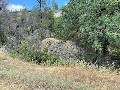
Above: a second smaller tailings pile exist just off Valparaiso Way in a gulch below a private residence. This photograph was taken by Jeremy Tuggle on May 22, 2021.

Above: a Shasta County Assessors Map - Book 204, Page 19, County of Shasta, dated: 2000.
RESOURCES:
Mineral Survey No. 4597, Plat of the Claim of R.P. Wheelock, known as the Tilton Consolidated Mine, embracing the Tilton, Dictator, New Redding Gold and Kamaaina Gold Mines. Surveyed by Alfred Baltzell, March 1907. Patented: February 3,1908.
Mine In Shasta To Be Sold - The Blue Lake Advocate newspaper of Blue Lake, October 24, 1925
Middle Creek & Lower Springs Mining District 622 Mining, available at the Shasta Historical Society
Shasta County Assessors Map - Book 204, Page 19, County of Shasta, 2000
No comments:
Post a Comment
Note: Only a member of this blog may post a comment.