This church has been a major part of the Glenburn community since it was established in 1885. Glenburn which is located in eastern Shasta County is an agricultural community, near Fall River Mills. This community has utilized this historic church since its beginning. Check out this historic site and property in this video below.
Welcome to Exploring Shasta County history... With this blog, I am bringing to life the stories of the early day pioneers and some of the oft-forgotten history of a bygone era in Shasta County, California. I'll also focus on important events after the turn of the 20th century. I would like to reflect upon current historical sites of the modern age as well. This is copyrighted by Jeremy M. Tuggle.
Thursday, August 25, 2022
The Historic Glenburn Community Church, Established 1885.
Sunday, August 14, 2022
The Historic Delta Cemetery
A follow up to my last video on, A History of Delta & Vollmers In, Shasta County. (Also Known as Bayles, California), this is the historic Delta Cemetery established in the 1900s. The earliest interment that I located was from 1907. Check it out and enjoy the video.
Monday, June 20, 2022
The Crystal Creek Water Ditch Trail of the Whiskeytown National Recreation Area -An 1850s Historic Water Ditch-
Wednesday, February 16, 2022
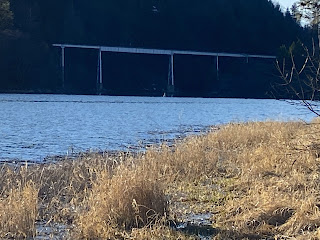
The Lake Britton Bridge and the Stand By Me Hollywood Movie Connection
Thursday, October 7, 2021
Shasta Lake Is Now Facing Its Second Worst Drought Year On Record
Sunday, October 3, 2021
A Foundation Of A Building Located Along the Shasta Route Railroad At Pollock
On October 2, 2021, Shasta Lake’s water level was recorded at 891.58-feet elevation wise below full pool or 175.42-feet below the crest of Shasta Dam for the third lowest record of all-time. By this date we were 2.09-feet away from the second lowest record set on November 29, 2014, of 889.49-feet below full pool elevation. This building was also located at Pollock on October 2, 2021, and is located just north of the historic Pollock bridge. Presumably, it is a building connected with the Shasta Route railroad.
Sunday, September 19, 2021
Bridge Bay Marina’s Sunken Boat Mystery, Shasta Lake, 9-17-2021.
Bridge Bay Marina’s Sunken Boat Mystery, Shasta Lake, 9-17-2021. Today’s Shasta Lake level is 897.53-Feet elevation wise or 169.47-Feet below the crest of Shasta Dam. This mysterious sunken boat must have a history, and Bridge Bay Marina wants to learn more about it. You might know the answer! What is it?
Saturday, September 18, 2021
Railroad Tunnel Number 4 Now Surfacing Out Of the Sacramento River Arm of Shasta Lake, 9-17-2021.
New YouTube video: Railroad Tunnel Number 4 Now Surfacing Out Of the Sacramento River Arm of Shasta Lake, 9-17-2021. Today’s Shasta Lake level is 897.53-Feet elevation wise or 169.47-Feet below the crest of Shasta Dam. Built 1884 and remodeled in 1925. See my video below:
Sunday, September 12, 2021
HISTORIC U.S. ROUTE HIGHWAY 99 AT TURNTABLE BAY AT SHASTA LAKE, 9-12-2021.
HISTORIC U.S. ROUTE HIGHWAY 99 AT TURNTABLE BAY AT SHASTA LAKE, 9-12-2021. AS OF TODAY, SHASTA LAKE IS 899.30-FEET ELEVATION WISE OR 167.70-FEET BELOW THE CREST OF SHASTA DAM AND IT IS 25% FULL.
Tuesday, September 7, 2021
History’s Mystery: A Closer Observation Of The Wooden Structure, Near Charlie Creek On The Sacramento River Arm Of Shasta Lake, 9-4-2021.
History’s Mystery: A Closer Observation Of The Wooden Structure, Near Charlie Creek On The Sacramento River Arm Of Shasta Lake, 9-4-2021. On That Date Shasta Lake Was 163.67-feet Below The Crest Of Shasta Dam Or 903.33-feet Elevation Wise Below Full Pool. Metal Detecting With GABRIEL LEETE. What is this structure near railroad tunnel number six at Charlie Creek? We’ve gotten some fantastic response as to what this is, so here is a personal look at this mysterious structure. Think you know what it is? Then, comment below here or on the earlier video of this wooden structure remember we’re not here to battle it out so please be respectful of other’s opinions.
Sunday, September 5, 2021
METAL DETECTING AT TUNNEL NO. 6 AT CHARLIE CREEK, AND BEYOND ON THE SACRAMENTO RIVER ARM OF SHASTA LAKE, 9-4-2021.
FULL TITLE: METAL DETECTING AT TUNNEL NO. 6 AT CHARLIE CREEK, AND BEYOND ON THE SACRAMENTO RIVER ARM OF SHASTA LAKE, 9-4-2021. ON THAT DATE SHASTA LAKE WAS 163.67-FEET BELOW THE CREST OF SHASTA DAM OR 903.33-FEET ELEVATION WISE BELOW FULL POOL.
Friday, September 3, 2021
SHASTA LAKE DROUGHT: SILVERTHORN RESORT, AND HISTORY, 8-30-2021.
SHASTA LAKE DROUGHT: SILVERTHORN RESORT, AND HISTORY, 8-30-2021. SHASTA LAKE WAS 161.26-FEET BELOW THE CREST OF SHASTA DAM OR 905.74-FEET ELEVATION WISE BELOW FULL POOL. TAKE A LOOK AT SILVERTHORN RESORT DURING THIS DROUGHT THAT WE’RE IN, AND EXPLORE SOME OF ITS EARLY HISTORY, AND LATER HERITAGE THAT MADE SILVERTHORN RESORT FAMOUS DURING ITS PRIME.
Tuesday, August 31, 2021
SHASTA LAKE DROUGHT: JONES VALLEY, AND HISTORY, 8-30-2021
SHASTA LAKE DROUGHT: JONES VALLEY, AND HISTORY, 8-30-2021 SHASTA LAKE IS 161.26-FEET BELOW THE CREST OF SHASTA DAM OR 905.74-FEET ELEVATION WISE.
Filmed on location by Jeremy Tuggle on 8-30-2021.
Wednesday, August 18, 2021
HISTORY’S MYSTERY: A WOODEN STRUCTURE ON THE SACRAMENTO RIVER NEAR CHARLIE CREEK ON SHASTA LAKE, AT 155.65-FEET BELOW THE CREST OF SHASTA DAM
HISTORY’S MYSTERY: A WOODEN STRUCTURE ON THE SACRAMENTO RIVER NEAR CHARLIE CREEK ON SHASTA LAKE, AT 155.65-FEET BELOW THE CREST OF SHASTA DAM OR 911.35 FEET ELEVATION WISE, 8-18-2021. WHAT IS THIS???
Tuesday, August 10, 2021
THE HISTORIC HEADTOWER AT SHASTA LAKE BEHIND SHASTA DAM
Sunday, August 8, 2021
SMOKEY CONDITIONS: WHISKEYTOWN LAKE POOR-UNHEALTHY AIR QUALITY, 8-8-2021.
Saturday, August 7, 2021
SMOKEY CONDITIONS: LAKE SHASTA HAZARDOUS AIR QUALITY, 8-6-2021.
Sunday, July 25, 2021
History’s Mystery: Sugarloaf Creek Structure at Lake Shasta.
History’s Mystery: Sugarloaf Creek Structure at Lake Shasta. Possibly a bunker but it looks home made, and it appears to have some type of lid over it aside from the opening. Its possible it belonged to an old house maybe a cellar (homestead I doubt it) it doesn't resemble a Water Well either. If you look closely you can see some type of metal in the concrete lid near the center. Another thought was that it might have been a home made Cold War era bunker. If we had more photos of this intriguing relic under Shasta Lake then we could generate more opinions too. It doesn't appear to be a box culvert either.... another reliable source says it is a: "sub-quality to the 1917 and 1925 Highway box culverts as seen in my photo albums therefore we assume its an earlier highway structure." He also mentioned that it looks to him that the upstream end has been bull dozed off from the culvert. Located off Lakeshore Drive at Lakehead… Lake Shasta is currently (July 23, 2021) 139.82-Feet below the crest of Shasta Dam.