Showing posts with label Nebraska. Show all posts

Monday, July 15, 2024

Oft Forgotten Places in Shasta County

This article might be turned into a series about oft forgotten place names in Shasta County, California, which were formerly up-and-coming places to live in our beautiful region of northern California. Let’s take a look at some of them today and explore their history below...


Above: an 1884-1914 map of Shasta County, California, showing Allen's Station or Allen. The United States Fish Hatchery at Baird on the McCloud River is also shown here. Source: Cal Topo.

Allen’s Station also known as Allen, it was a community which was overshadowed by the townsite of Baird, situated in Section 23, Township 34, North, Range 4 West and a half-mile north of the United States Fish Hatchery at Baird on the McCloud River. It was a settlement, resort and a favorite stopping place during its prime which attracted nationwide travelers. Local resident George Allen established this one-time thriving location in 1872. Years later, in 1881, a man named Intrepid Morse Wiley, became the operator of the resort and stopping place at this location which was also called Allen’s Station. Breakfast, lunch and dinner meals were sold for twenty-five cents a plate and the meals were prepped here by Wiley and his wife. 

It was a first-class hotel and restaurant with an open fireplace and comfortable furniture which made their patrons feel at home while lounging around. Swimming, and fishing were popular here along the river as well. However, it was no match for the new community of Baird becoming the larger community in the area and the Biard United States Post Office came to fruition by the United States Postal Service headquarters in Washington D.C., on April 8, 1878, with Myron Green as the first postmaster. The townsite of Baird and its U.S. Post Office was named in honor of Professor Spencer E. Baird, the first Federal Fish Commissioner. 

Later on, the Baird United States Post Office was discontinued on January 31, 1920, which made the population decline in the area. Eventually it was re-established again on October 16, 1929, and it wasn't until July 17, 1933, when it was discontinued again. Allen's Station and Baird are now under Shasta Lake, and in the end, Baird became an oft-forgotten place as well.


Above: the townsite of Baird, in Shasta County, outgrew the community of Allen's Station.
Courtesy of Shasta Historical Society.

Elderton, was an agricultural community where farming and stock-raising was the main industry which helped establish this community. This community was settled in 1860, and later that year, on October 17, 1860, John C. Divine took charge as the first postmaster of this United States Post Office, and it became a townsite complete with a rural general merchandise store which housed their United States Post Office. The townsite of Elderton was a booming location which was located four miles west of Cottonwood. However, the prosperous growth of the town of Cottonwood merged with this oft-forgotten locality and its United States Post Office became discontinued on September 20, 1862, as Cottonwood burgeoned with success and Elderton's mail route was rerouted to the Cottonwood United States Post Office at that time. 


Above: a list of post offices in California showing those in operation in March of 1853. Kilna (Potter's Ferry) is mentioned in the Shasta County group. It was one of three post offices in Shasta County at that time. From the Shasta Courier newspaper of Shasta, March 26, 1853

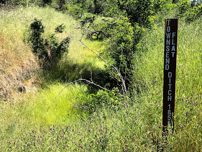
During 1852, the Wright Ferry, which was owned and operated by Eugene Wright & Otis Seaman sold their ferry to William Potter Jr., and Potter changed the name of this ferry to Potter’s Ferry which was then located one hundred yards south of the mouth of Spring Creek. Potter then relocated his ferry below the mouth of Rock Creek on the Sacramento River near Middle Creek (north of the present-day site of the Ribbon bridge.) Kilna, was a nearby settlement at the mouth of Middle Creek which was first settled in 1852 and later that year the United States Postal Service headquarters in Washington D.C., established a United States Post Office there on November 10, 1852, with William Potter Jr., as the first postmaster due to its flourishing population. It was located at the site of Potter’s Ferry, which was owned and operated by local ferryman, William Potter Jr., on the Sacramento River at Middle Creek. The town of Kilna boomed overnight and yet just as quickly as the townsite emerged out-of-nowhere it faded into becoming a footnote in history. On October 27, 1853, the United States Postal Service headquarters in Washington D.C., discontinued Kilna’s United States Post Office. William Potter Jr., was the last and only postmaster at this locality. The town of Kilna declined in population and it became deceased just as quickly as it emerged. Years later, a town called Waugh also known as Middle Creek formed at the same location as Kilna, and is now considered a ghost town along the Sacramento River Trail at Middle Creek with a few reminders of its hey-day remaining.


Believe it or not, Shasta County had a thriving mining settlement called Nebraska, which was located on Clear Creek, and situated in between the burgeoning towns of Texas Springs and Briggsville. Nebraska was a thriving community which saw an increase of population from 100 residents to 750 residents in 1855 due to lucrative gold strikes in the area.  Five years later, only two residents remained in this declining community due to the mines not producing lucrative ore, and by 1861 the settlement deceased. Even today, Texas Springs and Briggsville outgrew Nebraska and there are a few relics from those townsites which remain visible to the public eye.


Above: the town of Texas Springs is featured on the official 1862 map of Shasta County. Note: it's called "Texas" instead of Texas Spring and Briggsville is called "Briggs" instead of Briggsville. Nebraska is not mentioned on it had vanished before Colonel William MaGee surveyed this map in February of 1862. It became the first official map of Shasta County.


Pine View, was another booming lumber settlement which was first settled in 1884. It was located eight miles west of Shingletown and fourteen miles north-east of Balls Ferry. Pine View included a one-room schoolhouse which was established there on May 4, 1885, and was utilized to advance the education of the local school children in the area who were taught there by one teacher. The schoolhouse was erected in 1885 on the Balls Ferry to Shingletown Road approximately a half mile east of the Lack Creek bridge.


Later, the Pine View schoolhouse was relocated to an open meadow about a half-mile of Lack Creek bridge. Florence Pugh was the teacher here in 1899 and 1900. The school continued to be utilized until May 9, 1919, when the school was transferred into the Sheridan School District due to a decline in the community’s population which eventually was the death knell of this locality.


RESOURCES: 


List Of Post Offices - The Shasta Courier newspaper of Shasta, March 26, 1853


List Of U.S. Post Offices and Postmasters in the State of California - The San Joaquin Republican newspaper of Stockton, August 18, 1854


Clear Creek Ditch - The Shasta Courier newspaper of Shasta, October 27, 1855


Increase Of Our Population - The Shasta Courier newspaper of Shasta, November 3, 1855


List of Post Offices on the Pacific Coast - The Shasta Courier newspaper of Shasta, October 25, 1862


San Francisco Bulletin newspaper of San Francisco, March 15, 1879


The Free Press newspaper of Redding, March 8, 1884


The Free Press newspaper of Redding, May 10, 1884


Shasta County, California A History by Rosena Giles, published by Biobooks, ©1949.


Place Names of Shasta County by Gertrude A. Steger revision by Helen Hinckley Jones, ©1966 by La Siesta Press, Glendale, California

U.S., Appointments of U.S. Postmasters, 1832-1971

Thursday, May 14, 2020

Nathan A. Townsend: The Man Behind the Historic Townsend Flat Ditch


Above: the Townsend Flat Ditch on the left along with its marker on the right. This photograph was taken by Jeremy Tuggle on April 28, 2020.

Nathan A. Townsend was a native of New York who was born about 1824. Townsend arrived and settled at Middletown in Shasta County in 1853. Soon after, Townsend was elected as a member to the Shasta County Democratic Convention at Shasta in June of that year. He always supported the Democrat party in politics and while voting at the polls during election years. He mined on a flat near Horsetown which was named Townsend Flat in his honor.  

Townsend was the owner of the Union Hotel at Middletown in 1854. He was married to his wife May, a native of Illinois, as well. They operated the hostelry together, and aside from the hostelry business, Townsend was also a miner. 


This advertisement states, "Middeltown Ball. A ball will be given at the "Union Hotel", Middletown, on the evening of Tuesday, the 17th October. Every necessary arrangement will be made to make it go off agreeably. - N.A. Townsend". From the Shasta Courier newspaper edition of September 30, 1854.


Townsend claimed ownership to a number of mining claims a half mile below the town of Briggsville in the Clear Creek area.  In 1855, at this location, he built a dam and then he began the construction of a water ditch. This ditch originated on the north side of present day Saeltzer Dam at Clear Creek which is (unrelated to the Townsend dam). Clear Creek Road is not far from this ditch. The ditch stretched for a total of 6.4 miles long and empties into Olney Creek, it was completed that year. It brought him water to his mining claims which was used for the extraction of the gold he sought after.

That same year, the mining settlement of Nebraska situated along the Clear Creek area was coming to fruition with new settlers who were attracted to the local gold mining claims in the area. Nathan Townsend and his wife were among the first settlers of this community which never had a post office to send and receive mail. 

Apparently, Townsend went into partnership with a man named C.M. McKinney, and in May of 1858, they sued John D. Smith for damages to their ditch, dam and mining claims. Its unknown how extensive the damages to their property were. The case of McKinney & Townsend Vs. John D. Smith began that October and by November 6, 1858, the Shasta Courier newspaper published the following: 

"Interesting and Costly Suit - The case of McKinney & Townsend vs. J.D. Smith et al., that has occupied the District Court for about a month, elicited a greater amount of interest than any civil suit ever heretofore tried in our courts. It was rather an expensive affair. The jury fees alone amounted to upwards of $800, while the Clerk's fees amounted to perhaps a greater sum - to say anything of the fees and the sheriff and the lawyers." (SIC)

In December, the case of McKinney & Townsend vs. J.D. Smith was granted a new trial by the presiding judge the Honorable, William P. Daingerfield on motion of the defendants. It was then thought that the case would be tried by the Supreme Court, but eventually it was settled out of court. Additional disputes involving Nathan A. Townsend would soon emerge in the Shasta County Courts over his properties.

Later on, the 1860 U.S. Census records Nathan and Mary living in the county seat of Shasta. Nathan is recorded as "N.A." Townsend. There are no children mentioned on this record living in their residence. Nathan, also recorded $500 in real estate value on this record.  However, a son by the name of Wilbur was born to this union. It's possible there were other children.

The 1860 U.S. Census also records Nathan’s son Wilbur Townsend as “W.A.” Townsend who is living at Horsetown in the household of M. Patterson. Wilbur was working as a cook presumably at the Union Hotel in Middletown. Like his father, he was also a native of New York, and he was married to his wife Martha. Together they had two children, Lewis and Ada. Nathan's son Wilbur Townsend became the owner of the Union Hotel in 1861. 

In 1862, Nathan A. Townsend and his wife, Mary, were residing at Muletown, and in August of that year, he became a Justice of the Peace for that community. Townsend's partner C.M. McKinney was also the target of a lawsuit in the Shasta County District Court by Enos B. Taylor which during the above trial on the 16th of October 1862, on a judgement rendered at the June term of the said court in favor of Taylor for the sum of $5,499.17, with legal interests with the costs taxed in the sum of $143.45, in favor of Taylor. It was Shasta County Sheriff John S. Follansbee who was ordered by the court to sell the following described property at a future date, "The equal undivided one-half of the dam and ditch situate in the county of Shasta aforesaid, known as Townsend's dam and ditch, and which said dam and ditch were constructed for the purpose of taking the waters of Clear Creek from a point below Briggsville, and conveying the same on to mining and agricultural lands below said point. Also, one equal undivided one-half of all the farming claims and mining claims owned and possessed by the said N.A. Townsend, contiguous or in vicinity of said ditch; together with one equal undivided one-half of all the buildings on said premises, and the tools, sluice boxes, and all appurtenances thereunto below." (SIC)

Finally, on November 7, 1862, the above property was sold at auction to the highest bidder in Shasta. Unfortunately, the name of the buyer wasn't released by the local media. After 1863, not much is known about Nathan A. Townsend as he becomes untraceable in the United States Census records and information about him is unknown after this date. Nathan's son Wilbur Townsend relocated from Shasta County to the Nevada Township, in Nevada where his family was living in 1870. 

Years later, the Townsend Flat Water Ditch Company took over Nathan A. Townsend's earlier holdings along Clear Creek and his water ditch after this company was incorporated on December 3, 1890. The Townsend Flat Water Ditch Company dissolved in the early 2000's and most of the property was split up into private ownership under different people and parts of the ditch became the property of the McConnell Foundation. Today, this one hundred sixty-five year old water ditch still remains visible to the passing eye with trail markers marking its path along the Clear Creek Gorge Overlook and Trail, a pet-friendly, 3.5 mile long trail which ranges from easy to moderate along its path. Take plenty of water with you and the appropriate shoes, if you go. 


Above: the Townsend Flat Ditch trail marker. This photograph was taken by Jeremy Tuggle on April 28, 2020.


RESOURCES:

Shasta County Democratic Convention - The Shasta Courier newspaper of Shasta, June 11, 1853

Townsend & Co's Ditch - The Shasta Republican newspaper of Shasta, October 27, 1855

Clear Creek Ditch - The Shasta Courier newspaper of Shasta, October 27, 1855

District Court - May Term - The Shasta Courier newspaper of Shasta, May 22, 1858

Justice Made Cheap - The Shasta Courier newspaper of Shasta, October 9, 1858

Institutions - The Shasta Courier newspaper of Shasta, October 30, 1858

Interesting and Costly Suit - The Shasta Courier newspaper of Shasta, November 6, 1858

New Trial Granted - The Shasta Courier newspaper of Shasta, December 18, 1858

1860 U.S. Census

District Court Calendar - The Shasta Courier newspaper of Shasta, January 14, 1860

Justices and Inspectors of Election - The Shasta Courier newspaper of Shasta, August 17, 1861

Officers Of Election - The Shasta Courier newspaper of Shasta, August 23, 1862

Sheriff's Sale - The Shasta Courier newspaper of Shasta, October 25, 1862

Sheriff's Sale - The Shasta Courier newspaper of Shasta, November 1, 1862

Place Names of Shasta County by Gertrude Steger, published by La Siesta Press, ©1966.